Lima, the capital of Peru, was founded on January 18th, 1535. Francisco Pizarro called Lima «the City of the Kings». Lima emerged on the native cacique Taulichusco lands. Nowadays, after almost 5 centuries, Lima has turned into a modern, emerging and developed city that at the same time preserves proudly its convents and colonial buildings, as well as the richness of its historic center that has been declared by UNESCO as Cultural Heritage of Humanity.
On the Lima tours you will know beautiful architectural jewels. For example, the Cathedral of Lima, that was built the same day of the city’s founding, the San Francisco Church and Convent and the San Pedro and Santo Domingo Churches. In addition, the big old houses like La Casa Aliaga that was built over the chapel of the native cacique Taulichusco, as well as the big old house of Goyeneche or house of Rada and the magnificent Torre Tagle Palace from the XVIII century.
Lima also has pre-Hispanic archaeological remains like the Great Sanctuary of Pachacamac where the Pachacamac god was worshiped, and also the Huaca Pucllana (400 a.c) located in Miraflores district. Miraflores is an important administrative center in Lima.
Lima gathers its colonial past, the indigenous culture from which it inherited its name from the Aimara word Limac-Huayta, as well as the modernity that focuses on the future.

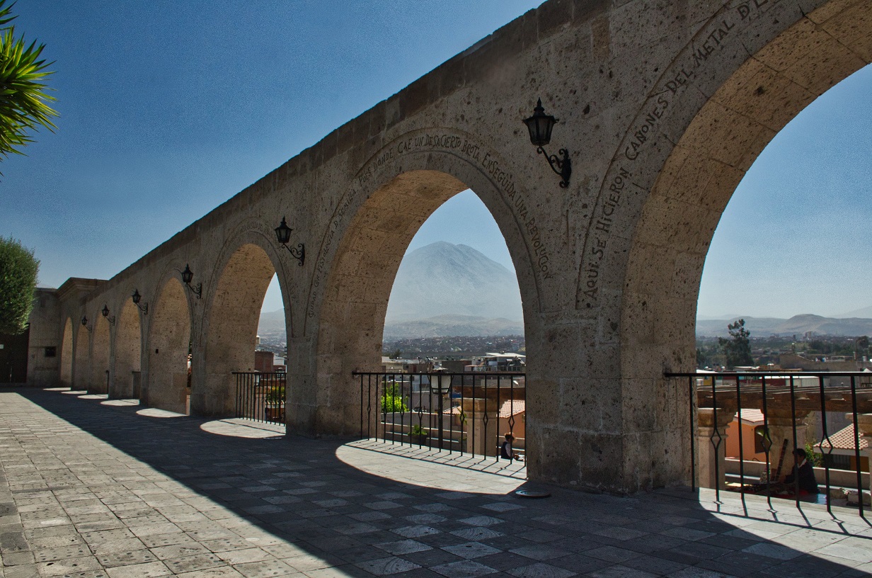
Arequipa city is located by one side of the Misti Volcano on the Andes Mountain Range. Arequipa (2.350 meters above sea level), is the capital of the department of Arequipa. The big old buildings, the temples, convents and monasteries are built with a volcanic lava material called « sillar ». Sillar has a white pearly color that the sun rays illuminate, which is the main reason why Arequipa is called «the White City».
The buildings in the Historic Center of Arequipa have an original architectural style. The Italian Baroque style, the Spanish Plateresque style and the Andean originality were mixed. The Historic Center of Arequipa is surrounded by a magical countryside and fascinating villages where we can still see pre-Inca agricultural terraces or « andenes » that are still used by the farmers of the villages of Chilina, Socabaya, Paucarpata, Characato and Sabandia.
In the department of Arequipa, we can find two of the deepest canyons of the world that you can discover when you travel to Arequipa: The Colca Canyon (located in the province of Caylloma) and the Cotahuasi Canyon (located in the province of La Union). We can also find the fascinating Valley of Volcanoes located in Andahua and the beautiful Mollendo, Camana and Puerto Inca beaches.
The Colca Valley is in Arequipa, three hours by car from the capital. It is one of the region’s main tourist destinations because we can find one of the deepest canyons of the world there, along with beautiful landscapes, fauna and a living culture we can still admire in our Arequipa trips.
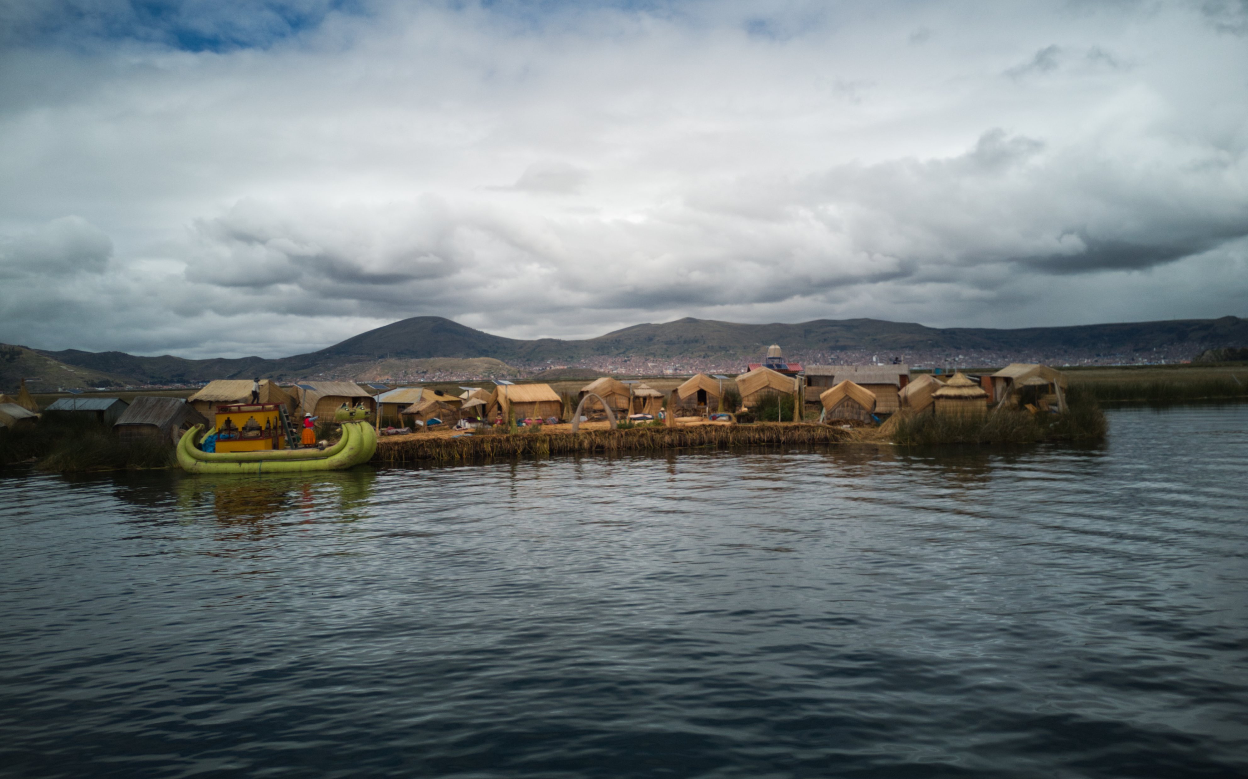
Puno is located on the Lake Titicaca bank. Puno has a special magnetism that seems to come out of its mountains. Its lake is resembles the ocean.
Puno, which is located in the south of Peru, was dominated by the Tiahuanaco culture. Puno is the maximum expression of the Aymara culture development. This can be appreciated in the archaeological remains found in this area.
The legend tells that from the Lake Titicaca waters emerged Manco Capac, the first Inca, and his wife Mama Ocllo, both children of the sun, to found the city of Cusco. They founded a huge empire as ordered by the sun god.
The Lake Titicaca is the highest navigable lake in the world. It is located at 3.815 meters above sea level, and it is the second largest lake in South America with an 8.400-square-kilometer surface.
On the Puno tours you will know the Titicaca National Reserve which has an area of 36,180 hectares. Their presence seeks to conserve the wild flora and fauna of Lake Titicaca, support the socio-economic development of the region and maintain the cultural traditions of the human populations that inhabit the vicinity of the lake.
Puno has, undoubtedly, the richest folklore because of its variety and color, and it makes Puno stunning to the eyes of the world. Its greatest cultural expression is the Candelaria Festival that is celebrated in February and which you can enjoy in our Puno city tour.
Nowadays, Puno is an important agricultural and cattle raising area, especially because of the llamas and alpacas (South American camelids). The inhabitants of Puno still preserve old traditions and festivals that existed many centuries ago and that you can enjoy when you travel to Puno.
Know our suggested journeys visiting the Lake Titicaca.
Our team will be contacting you as soon as possible.
